Living at the Lake’s Edge: Excavations at the Graeco-Roman Settlement of Qarah el-Hamra in the Fayum, Egypt
Emily Cole
Visiting Assistant Professor, 2016-18
Postdoctoral Scholar, Center for the Tebtunis Papyri, University of California, Berkeley
This article first appeared in ISAW Newsletter 22 (Fall 2018).
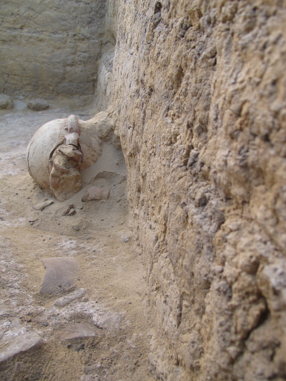
 In a ground-floor room of one of the excavated houses, pottery vessels and other artifacts are found resting on the surface and against the walls where they were abandoned. These contextualized ceramics will be used to reconstruct a history of life at Qarah el-Hamra
If Egypt is a gift of the Nile, then the Fayum is one of its gems. Located about an hour’s drive southwest of Cairo, the Fayum depression has been filled by water diverted from the Nile since prehistoric times. To varying degrees throughout its history, the centralized Egyptian state concentrated resources on exploiting this rich agricultural region for the cultivation of grain, grapes, olives, and other commercial crops.
Under the rule of the Ptolemaic kings in the late 4th century BCE, new settlements were founded in order to maximize production in the area. Of these, many are famous for their spectacular finds of papyri, mummies, temples, and estates. They are fantastic displays of everyday life in urban centers, as the dry sand has preserved ancient remains to a degree similar to Pompeii. These towns, however, present only one side of ancient life. The region was not exclusively populated by temple officials and elite landowners living in developed centers.
To provide a more nuanced understanding of where people lived in the Fayum, I am co-directing excavations at Qarah el-Hamra, a small 2-hectare town site on the north shore of Lake Qarun, with my colleague, Dr. Bethany Simpson. The site exists at the edge of what would have been cultivatable land, with desert to the north and west, the lake to the south, and marshes to the east. Our priority has been to complement on-going archaeological work at well-known sites like Karanis, Soknopaiou Nesos, and Tebtunis with the detailed analysis of faunal and botanical remains as well as domestic mudbrick architecture and small finds from the site (above).
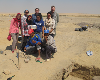
 Several trenches were excavated at the site by an international team of archaeologists with the help of colleagues from the Egyptian Ministry of Antiquities
Our 2018 season was dedicated to processing excavation material that was collected in 2004 and 2016 (right). It was generously supported by funding from the Rust Family Foundation and ISAW. From our new understanding of this material, we can now speak of a village economy largely dependent on fishing in Lake Qarun, but also connected to trade in goods from other sites in Egypt and abroad. Villagers borrowed architectural styles from their larger neighbors, most noticeably Karanis, which at 10 km away as the crow flies, was the closest large town to Qarah el-Hamra. While the lake provided the primary reason for Qarah el-Hamra’s existence, it was also the source of its eventual abandonment. A rising water table and gradual flooding of the site, meant that it was abandoned well before the 7th century CE. Despite these insights, there are several important questions that remain to be answered. For instance, the ancient name for Qarah el-Hamra remains a mystery! In future seasons, we will continue to look for answers, and in so doing, shed light on where the inhabitants of Qarah el-Hamra fit within the broader urban fabric of Graeco-Roman Egypt.
For further information on the project and to keep up with our progress, visit our blog: https://www.facebook.com/QHfayumproject/ (no sign-up to Facebook is required to access the posts).