Map
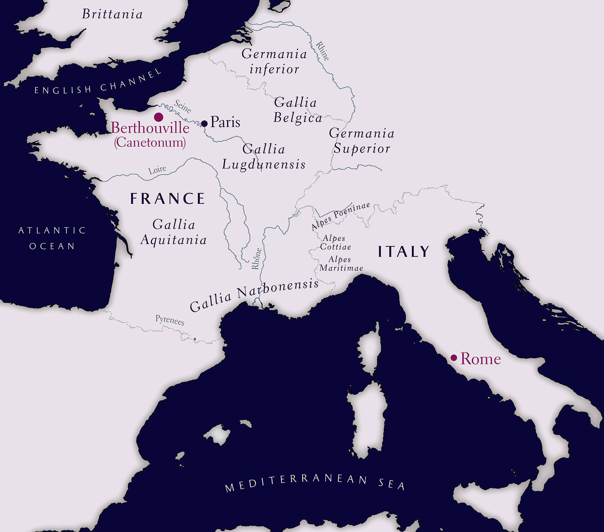
This map illustrates the geographic context of Berthouville, findspot of many of the objects included in the "Devotion and Decadence" exhibition, by placing it in the western portion of the Roman Empire. Links in this text will take you to entries for the corresponding places in the Pleiades gazetteer of the ancient world. Lying in the modern region of Normandy, just south of the Seine river, Berthouville is also labeled with the ancient Latin name "Canetonum," which some scholars have given to the ancient sanctuary there based on the name of its tutelary god: Mercury Canetonensis. It was common for ancient gods to have unique epithets at different temples; this particular epithet is attested only on a few of the inscribed objects included in this exhibition.
The map itself spans the area from southern Britannia in the northwest to the foot of the Italian peninsula and the island of Sicily in the southeast. The major bodies of water taken in by the map are labeled: The English Channel, Atlantic Ocean, and Mediterranean Sea. The Adriatic sea is shown too, but not labeled. The locations of Rome and of Paris are the only sites indicated, other than Berthouville. The Roman provinces lying between the Pyrenees mountains and the Rhine are labeled (south to north): Gallia Narbonensis, Gallia Aquitania, Gallia Lugdunensis, Gallia Belgica, Germania Inferior, and Germania Superior. So are the alpine provinces of Alpes Maritimae, Alpes Cottiae, and Alpes Poeninae. In addition to the Seine and the Rhine, the Rhône and the Loire rivers are drawn and labeled.