Faculty Focus: Sören Stark
New Excavations in the City Center of Bukhara: Results of the 2020 Season
Sören Stark, Jamal K. Mirzaakhmedov, Siroj J. Mirzaakhmedov, Asan I. Torgoev, and Robert N. Spengler III
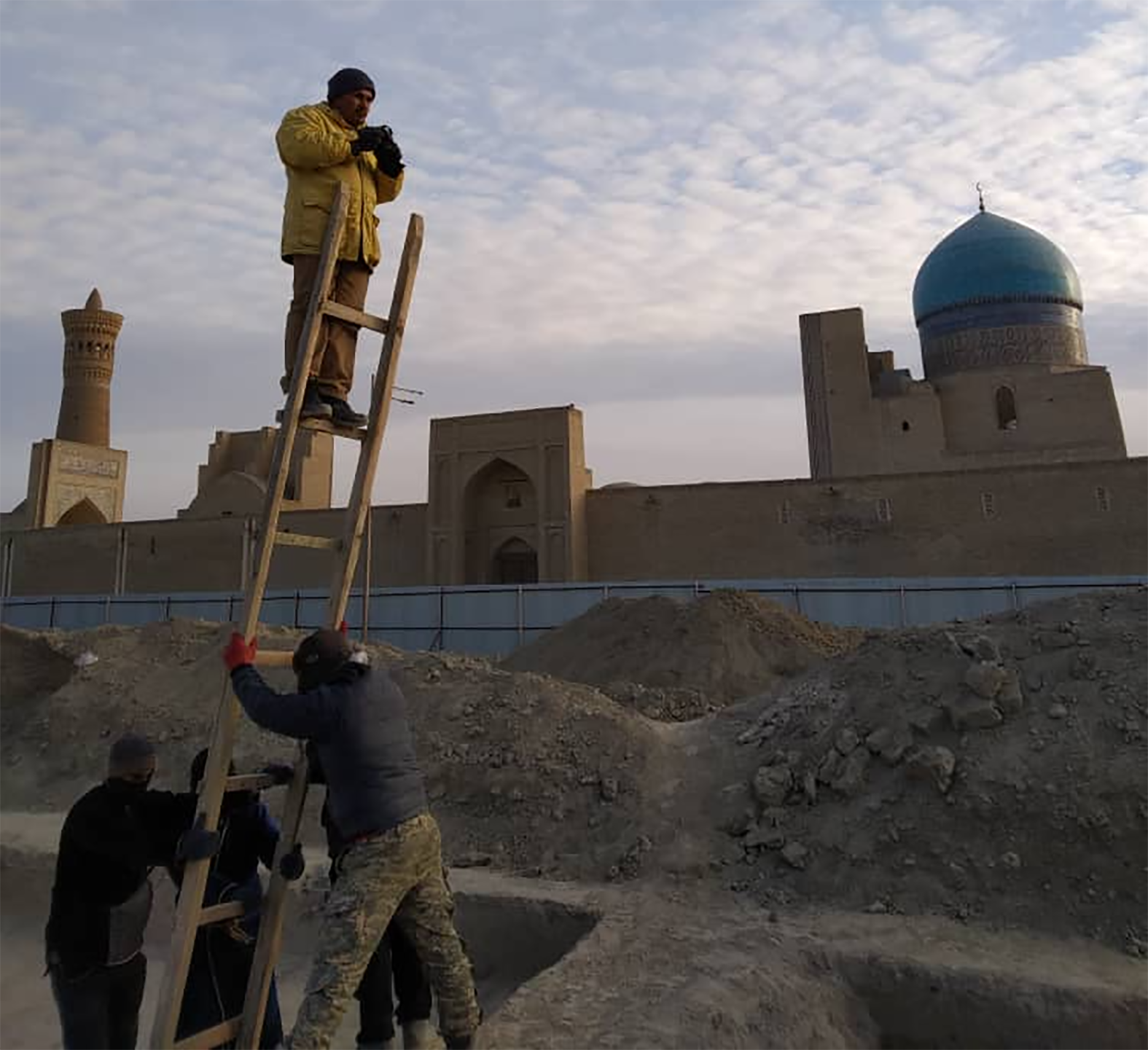 Figure 1: Click to Enlarge.
Despite the many difficulties posed by the ongoing Covid-19 pandemic a team of the Uzbek-American Expedition to Bukhara, co-directed by Sören Stark (ISAW), and Jamal K. Mirzaakhmedov (Uzbek Academy of Sciences, Samarkand-Tashkent) managed to carry out a highly successful season of fieldwork. It took place between early October and mid-December in an area immediately to the north of the city’s Friday mosque and ca. 150 m to the southeast of Bukhara’s citadel. In the early middle ages, this area was located at the western limits of the city proper – called madīnah or shahristān in early-medieval Arabic and Persian sources, within the early medieval city wall, just to the north of the ‘Gate of Mihr’ (later called ‘Gate of the Banū Asad’). In the 19th and early 20th century, this was a neighborhood of elite residences, inhabited by officials and courtiers. These residences burned down during the aerial bombing of the city by the Red Army in 1920, after which a part of this area to the north of the Friday Mosque housed an open bazaar. This bazaar was recently demolished in order to replace it with a new market building – hence the opportunity for, and urgent need of rescue excavations at this very spot.
Figure 1: Click to Enlarge.
Despite the many difficulties posed by the ongoing Covid-19 pandemic a team of the Uzbek-American Expedition to Bukhara, co-directed by Sören Stark (ISAW), and Jamal K. Mirzaakhmedov (Uzbek Academy of Sciences, Samarkand-Tashkent) managed to carry out a highly successful season of fieldwork. It took place between early October and mid-December in an area immediately to the north of the city’s Friday mosque and ca. 150 m to the southeast of Bukhara’s citadel. In the early middle ages, this area was located at the western limits of the city proper – called madīnah or shahristān in early-medieval Arabic and Persian sources, within the early medieval city wall, just to the north of the ‘Gate of Mihr’ (later called ‘Gate of the Banū Asad’). In the 19th and early 20th century, this was a neighborhood of elite residences, inhabited by officials and courtiers. These residences burned down during the aerial bombing of the city by the Red Army in 1920, after which a part of this area to the north of the Friday Mosque housed an open bazaar. This bazaar was recently demolished in order to replace it with a new market building – hence the opportunity for, and urgent need of rescue excavations at this very spot.
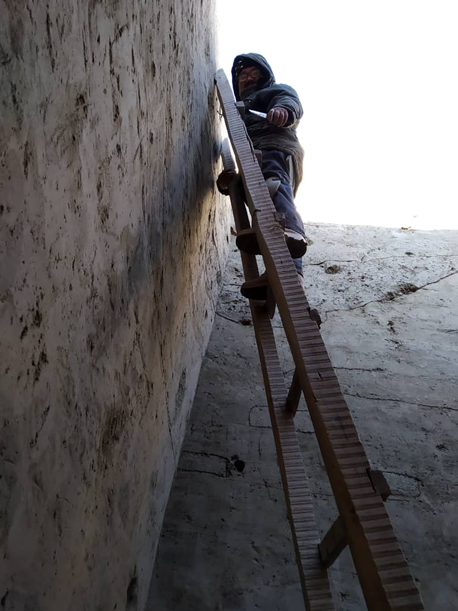 Figure 2: Click to Enlarge.
Our 2020 field team consisted of Jamal K. Mirzaakhmedov, Siroj J. Mirzaakhmedov, and Husniddin Rakhmonov of the Uzbek Academy of Sciences. We were joined by Asan I. Torgoev, senior researcher at the State Hermitage in Saint-Petersburg (Russia). Our work was supported by Robert N. Spengler III and his team at the Max Planck Institute for the Science of Human History in Jena (Germany) who will also conduct the paleobotanical analysis of our soil samples.
Figure 2: Click to Enlarge.
Our 2020 field team consisted of Jamal K. Mirzaakhmedov, Siroj J. Mirzaakhmedov, and Husniddin Rakhmonov of the Uzbek Academy of Sciences. We were joined by Asan I. Torgoev, senior researcher at the State Hermitage in Saint-Petersburg (Russia). Our work was supported by Robert N. Spengler III and his team at the Max Planck Institute for the Science of Human History in Jena (Germany) who will also conduct the paleobotanical analysis of our soil samples.
We concentrated our efforts in the southwestern part of the future construction site in a total of four trenches. Two of them yielded particularly interesting results.
In the first trench (Trench 4) we collaborated with our colleague Asan I. Torgoev, who already in 2019 had started excavating a residential quarter dating to the time of the Arab conquest (end of the seventh/first half of the eight century). By continuing and extending this trench, we discovered that these buildings partially covered the remains of the western city walls. The excavated part – i.e. the wall’s base – was constructed of rammed earth (called pakhsa in Uzbek and Tajik); currently two major construction phases can be identified, which seem to roughly date to the 5th and 6th centuries. In front of the wall ran a substantial ditch. Judging from the oldest ceramic finds from stratified micro layers inside the ditch, it was dug out (perhaps by deepening and broadening a natural watercourse) also during the 5th or 6th centuries. These dates are important because they tell us when Bukhara turned into a fortified settlement – a true city.
 Figure 3: Click to Enlarge.
The second trench (Trench 3) of particular interest is located ca. 40 m further to the southeast, just north of the old central east-west axis of the madīnah/shahristān, once running between the ‘Gate of Mihr’ in the west and the ‘New Gate’, today’s Khoja Nurobod Street. Right below the present-day surface we uncovered a number of 11th-12th century cesspits. One in particular, pit 39, reaching 5.2 m deep into older archaeological strata yielded an enormous amount of residential waste: mostly Samanid and Qarakhanid period ceramics and glassware, but also metal tools, coins and spindle whorls. Of particular interest is a complete 11th century jar, which is remarkable both for its beautiful filter with peacocks-at-tree scene, as well as for its Arabic inscription in black ink (still awaiting reading).
Figure 3: Click to Enlarge.
The second trench (Trench 3) of particular interest is located ca. 40 m further to the southeast, just north of the old central east-west axis of the madīnah/shahristān, once running between the ‘Gate of Mihr’ in the west and the ‘New Gate’, today’s Khoja Nurobod Street. Right below the present-day surface we uncovered a number of 11th-12th century cesspits. One in particular, pit 39, reaching 5.2 m deep into older archaeological strata yielded an enormous amount of residential waste: mostly Samanid and Qarakhanid period ceramics and glassware, but also metal tools, coins and spindle whorls. Of particular interest is a complete 11th century jar, which is remarkable both for its beautiful filter with peacocks-at-tree scene, as well as for its Arabic inscription in black ink (still awaiting reading).
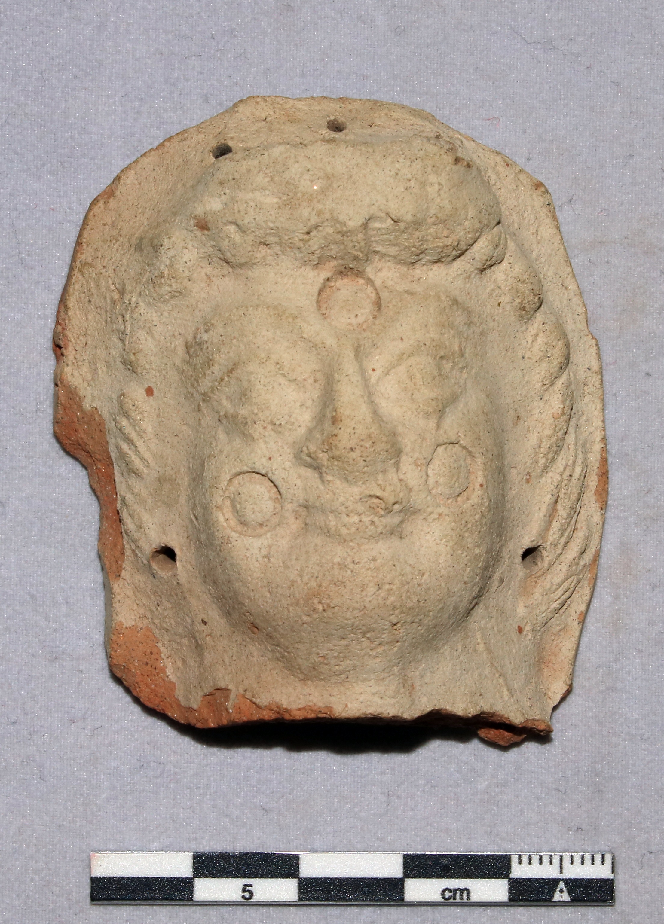 Figure 4: Click to Enlarge.
However, arguably the most exciting discovery of our 2020 season was made further down, at a depth of 3.5 m below the present-day surface: the remains of a massive, ca. 5.6 m wide wall, constructed of mudbricks of square format (50-52 x 50-52 x 10 cm) and sitting on a pakhsa socle, running roughly parallel to the central east-west axis between the ‘Gate of Mihr’ and the ‘New Gate’. Interestingly, mudbricks of such a size and format are characteristic in the wider region for the period of antiquity, that is between the 3rd century BCE and the 3rd century CE – a period in the long history of Bukhara that is still very insufficiently known to us. We only know that in the 3rd century BCE a fortification appears on a natural elevation at the place of the later citadel with a presumably unfortified settlement spreading to the east of it over some lower hillocks and along several natural river arms. However, the entire period between the 3rd century BCE and the 3rd century CE is only very sparsely illuminated by isolated finds, mostly ceramic sherds and terracotta figurines (in fact we found a nicely executed head fragment of a specimen of a terracotta figurine together with later deposits in yet another trench (Trench 1). But until now no architectural remains of this settlement had ever been found – lending particular importance to this discovery: This monumental wall represents the first and only architecture ever found in the area of Bukhara’s early-medieval madīnah/shahristān dating back to antiquity.
Figure 4: Click to Enlarge.
However, arguably the most exciting discovery of our 2020 season was made further down, at a depth of 3.5 m below the present-day surface: the remains of a massive, ca. 5.6 m wide wall, constructed of mudbricks of square format (50-52 x 50-52 x 10 cm) and sitting on a pakhsa socle, running roughly parallel to the central east-west axis between the ‘Gate of Mihr’ and the ‘New Gate’. Interestingly, mudbricks of such a size and format are characteristic in the wider region for the period of antiquity, that is between the 3rd century BCE and the 3rd century CE – a period in the long history of Bukhara that is still very insufficiently known to us. We only know that in the 3rd century BCE a fortification appears on a natural elevation at the place of the later citadel with a presumably unfortified settlement spreading to the east of it over some lower hillocks and along several natural river arms. However, the entire period between the 3rd century BCE and the 3rd century CE is only very sparsely illuminated by isolated finds, mostly ceramic sherds and terracotta figurines (in fact we found a nicely executed head fragment of a specimen of a terracotta figurine together with later deposits in yet another trench (Trench 1). But until now no architectural remains of this settlement had ever been found – lending particular importance to this discovery: This monumental wall represents the first and only architecture ever found in the area of Bukhara’s early-medieval madīnah/shahristān dating back to antiquity.
Currently this wall has been exposed only at a length of ca. 2.5 m, so at this point the question of its function must remain open. However, judging from its slope it seems to face southwards, in the direction where later the east-west thoroughfare of the early-medieval city was situated. From previous excavations in the city center we know that much earlier, at the beginnings of the settlement during the 3rd century BCE, a watercourse in form of a natural river arm ran along this east-west axis. Perhaps this massive wall and its pakhsa socle represents an embankment, suggesting that this river arm was at some point between the 3rd century BCE and the 3rd century CE channeled in order to prevent frequent flooding of the settlement. This hypothesis is in accordance with the fact that the southern façade of our wall is covered by multiply layers of riverine sands and silt lenses.
More excavation is necessary to further substantiate this hypothesis. Thus, we hope to renew our investigations in this area in 2021 and to throw additional and much needed light on the first stages of the formation of ‘Bukhara the Noble’ – one of Central Asia’s major metropoleis.