The ancient past as a game setting: Abstraction and accuracy
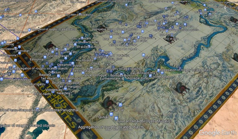
Recently, while planning for an ISAW Library Game Night, I discovered that a fellow board gamer had georeferenced the game board of Reiner Knizia’s game Tigris and Euphrates in a KMZ file. Intrigued, I opened the file up in Google Earth—forgetting that I had left the Pleiades dataset open the last time I had used the program. When the file opened, I was presented with an accidental mash-up, showing the slightly-abstracted Mesopotamia of Tigris and Euphrates overlaid with points from Pleiades representing the locations of Mesopotamian cities. The game board, I noted, seemed more concerned with the rivers than the cities: the starting cities of the game, represented by lamassu squares, bear little relation to the actual location of Sumerian, Babylonian, and Akkadian urban centers. But, had it followed their locations more precisely, it would no doubt have impacted the playability of the game. It was an unexpected and fascinating combination of play and research, past and present, concrete and abstract.
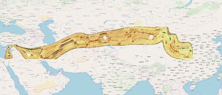
Seeing this made me wonder-- how accurate are other game boards? I decided to try a similar approach with a game board I knew to be highly abstract—Ted Cheatham and Bruno Faidutti’s Silk Road. This trade-based game puts its players into the roles of merchants traveling from Chang’an to Antioch, but with a highly regularized representation of the geography inbetween. Using QGIS, I applied points for the nineteen cities represented on the game board, and the resulting image—shown below overlaid on a base map from OpenStreetMap—shows just how abstract the game renders the historical geography. As with Tigris & Euphrates, that abstraction makes perfect sense in the setting of a game-- otherwise it would be difficult to fit two pieces side-by-side on the western end of the board.
At the opposite end of the spectrum is Esagil, a game designed by Assyriologist Marie Françoise Bernier with a board based on the city plan of Babylon. Here is the georeferenced game board, shown semi-transparent over Google Earth imagery of the Babylon site in QGIS:
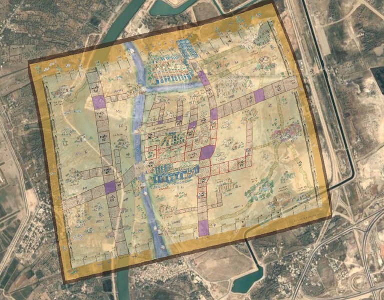
The board hardly needs any distortion to map onto the actual site, but this attention to accuracy has indeed affected the size and location of the game spaces.
This tension between accuracy and abstraction in games based on antiquity is just one theme that we at the ISAW Library are interested in exploring further. To that end, the ISAW Library is proud to host Re-Rolling the Past: Representations and Reinterpretations of Antiquity in Analog and Digital Games. This one-day conference, organized by ISAW Visiting Assistant Professor Daniela Wolin and ISAW Librarian for Collections and Services Gabriel Mckee, will be held on Friday, March 27, 2020. An official announcement and RSVP link will be available soon, but in the meantime, mark your calendars for a program that will explore the ways in which games—including board games, video games, and role-playing games—can be used to elucidate, explore, and sometimes distort the ancient past.