Travel the Roman Empire with Stanford Orbis
ORBIS: The Stanford Geospatial Network Model of the Roman World simulates the time and price costs of travel by land, river and sea across the mature imperial transportation network, notionally approximating conditions around 200 CE.
The model links some 750 Roman-era sites, spread across 10 million square kilometers, by means of principal roads, navigable rivers and canals, and major sea routes. It simulates movement across this network, using a wide variety of transport: fourteen different ways of traveling by road, from walking to horse relays; civilian and military river boats; and two types of sailing ship with slightly different navigational and performance parameters.
You can experiment with some functions of the ORBIS model yourself, via the project website. The online path-finding interface lets you simulate travel between any two of the 750 points in the model. Rudimentary dynamic distance cartograms will give you a sense of route costs and differences in the connective topology of the Roman world as a function of season or center.
Information on terrestrial and riverine travel speed was gathered from ancient and later premodern sources, and adjusted for significant changes in altitude. Mean sailing speed is computed by an algorithm that simulates the response of Roman-style sail ships to winds and currents. Sailing paths and speeds take account of monthly variation in meteorological conditions reported by standard nautical manuals. You can read more about the elements of the model and how it was constructed at "Building ORBIS."
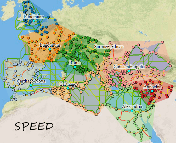
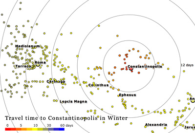
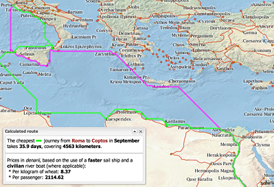
The large map cycles through visulations of "closest" proximity to key regional centers as calculated by the model in three different ways: travel distance, travel time, and travel expense. An isochronic diagram illustrates travel time from various settlements to Constantinople (modern Istanbul). The smaller map illustrates two route options (cheapest vs. fastest) for a trip from Rome to Coptos (modern Qift) in Egypt.