Explore Peutinger's Roman Map
The so-called "Peutinger Map" is the only Roman world map known to have survived antiquity. Preserved in a single, medieval copy now housed in the Austrian National Library in Vienna, the map stretches from Britain in the west to India in the east, covering a series of 11 parchment rectangles totaling over 6.7 meters (22 feet) in length. A full-scale facsimile is on display in the galleries and more information is provided on two of the exhibition banners: "Measuring and Mapping Space" and "Peutinger Map".
In preparing his 2010 book on the subject (Rome's World: The Peutinger Map Reconsidered; Cambrige UP), Richard Talbert collaborated with the staff of the Ancient World Mapping Center at UNC Chapel Hill and with ISAW's Digital Programs team to produce digital tools that were used to record and analyze the map. These have been published online so that students and scholars can verify his findings and form their own impressions of the map and its content. These include:
- Peutinger Map Viewer (see illustration), with an accompanying User's Guide (pdf).
- Database of Peutinger Map Names and Features
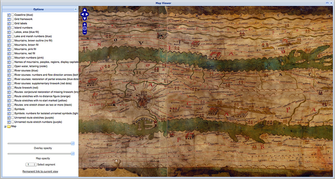
Click the image to launch the Peutinger Map Viewer at peutinger.atlantides.org